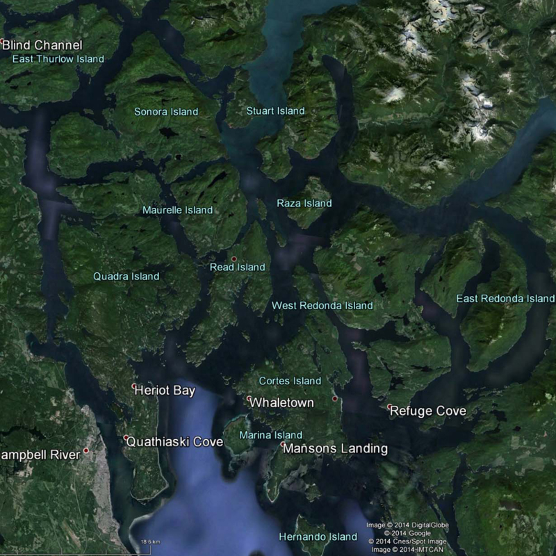


DIEM MAPS
DIEM’s base-maps are the result of GIS digital information processing that identifies terrestrial and freshwater ecosystems and geological features. They include the following:
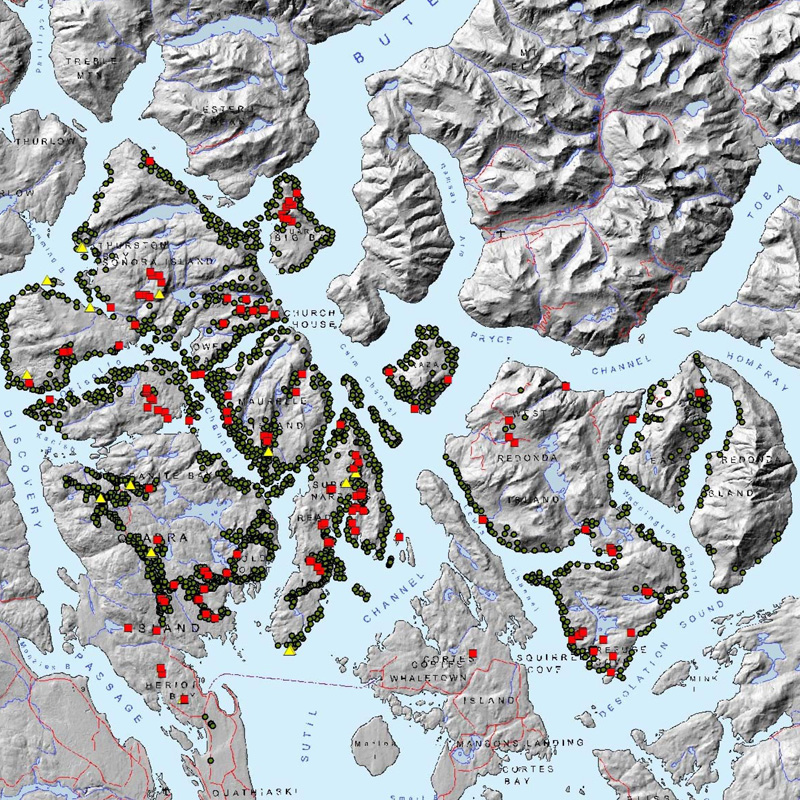
 Protected Landscape Network (PNL) This set of maps tells a story about Read Island’s network of forests, freshwaters, and other sensitive ecosystems.
![]() Sensitive Ecosystem Inventory (SEI) maps ecosystems which are fragile, rare or sensitive to development.
Sensitive Ecosystem Inventory (SEI) maps ecosystems which are fragile, rare or sensitive to development.
![]() Enduring Features maps biophysical attributes that influence and sustain the area’s ecosystems.
Enduring Features maps biophysical attributes that influence and sustain the area’s ecosystems.
![]() Watersheds Analysis DIEM’s mapped data enables digital filtering processes to measure and illustrate a variety of past, present, proposed, and cumulative impacts.
Watersheds Analysis DIEM’s mapped data enables digital filtering processes to measure and illustrate a variety of past, present, proposed, and cumulative impacts.
 DataBasin.org This site has user-friendly mapping tools that provide numerous ways to view, explore, map and access spatial data outcomes from the DIEM project.
![]() Community Maps Last but not least, citizen mapping adds important real-observations and our own stories that help to document what was and what is – as well as what’s important for the future.
Community Maps Last but not least, citizen mapping adds important real-observations and our own stories that help to document what was and what is – as well as what’s important for the future.